Climate
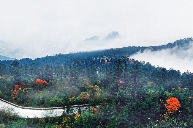
Mt. Emei is frequently covered in dense cloud and mist, with few sun exposure and ample rainfall. The plain part has a humid subtropical monsoon climate, with the average temperature in January and July reaching 6.9°C and 26.1 °C respectively. Due to high altitude and steep gradient, its vertical climate zones are very obvious. Area at 1500-2100 meters high has a warm temperate climate; area at 2100-2500 meters high enjoys a mid-temperate climate; area at 2500 meters high or above is in the sub-polar zone. Areas at 2000 meters high or above are covered with ice for about half a year from October to April in the following year.
Climate feature of Mt. Emei Scenic Area varies according to the changes in elevation. Areas below Qingyin Pavalion belong to low-elevation area, where plants are abundant with cool wind and limpid springs. Temperature in the area has no big difference from that in the plain; therefore, it is advised to wear additional clothes in the morning and evening. Mid-elevation area means areas from Qingyin Pavalion to the Xixiang Temple, where temperature is 4°C to 5°C lower than that in the plain, so it is necessary for tourists to prepare more clothing. In the high-elevation area, namely, areas from Xixiang Temple to the Golden Summit, people are like walking in the clouds. There are cold winds and sudden downpours in this area, with a temperature that is 10°C lower than that in areas like Baoguo Temple. Tourists can rent cotton-padded overcoat here. There is a boundary line in Mt. Emei, the lower and upper part of which are referred to as rainy region and non-rainy region respectively. As cumulus clouds have weight, they normally stay around the boundary line. As a result, tourists may hear thunders at Golden Summit, but they may not experience the rainfall because it only rains in the rainy region.
